Drones and Mapping: Capturing High-Quality Aerial Data for Various Applications
Drones have revolutionized the art of surveying and mapping. They can gather data from remote or inaccessible areas, which was not possible before, making them an essential tool for various industries. Here are some reasons why drones are used for surveying and mapping.
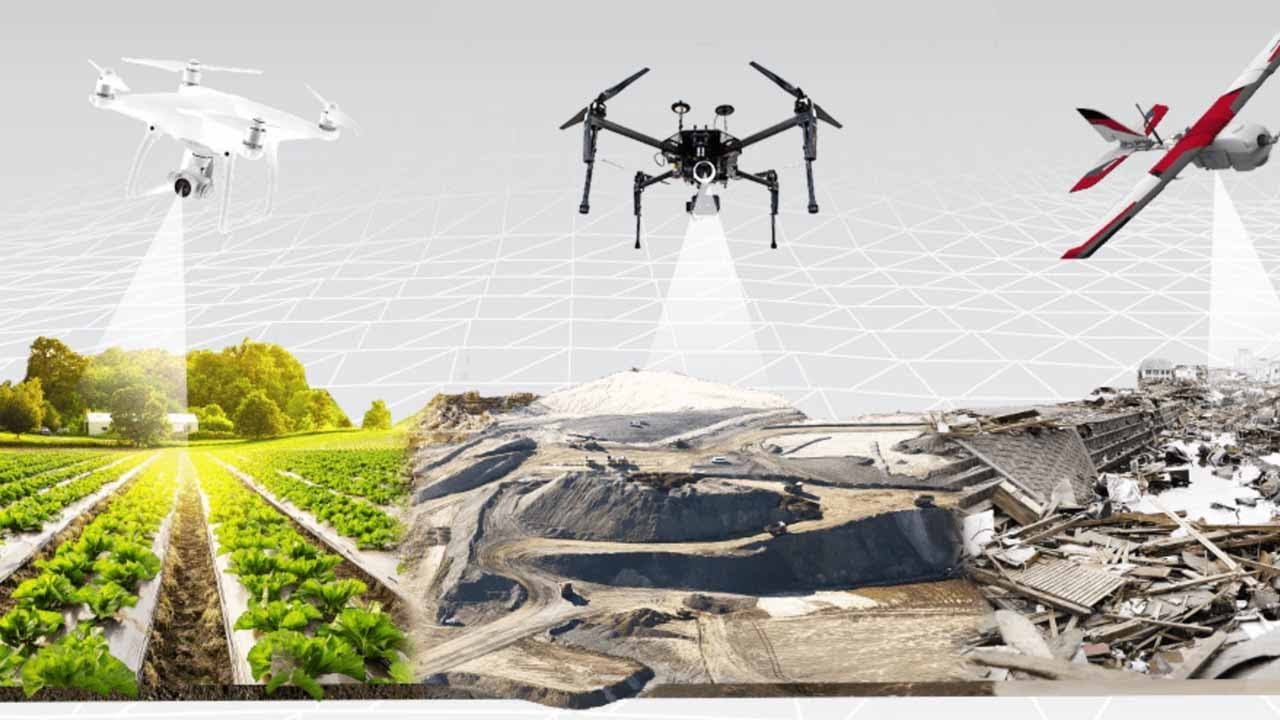
First Image
Abstract
Drone technology provides an efficient and cost-effective way to gather accurate and high-resolution data for surveying and mapping projects. It has the potential to improve the accuracy of data and reduce the time and resources required for project completion. However, implementing this technology requires specialized expertise and knowledge.
Introduction
In recent years, drones have become a popular tool for surveying and mapping projects. The ability to capture high-resolution images and data from a higher vantage point has made drones an obvious choice for accessing remote or inaccessible areas. The technology used in drones has advanced rapidly, making it possible to analyze the data that drones capture accurately.
The use of drones for surveying and mapping has various applications across different industries. From infrastructure and construction to mining and agriculture, drones have proved to be an effective tool for gathering data and providing insights that were not possible before.
Content
Drones have the potential to revolutionize the way surveying and mapping are done. They can take high-resolution images of large areas quickly, and their data help mapping and surveying professionals to get more accurate information. This data can be used to create 3D models, maps, and other essential data points that are essential for various industries.
The biggest advantage of using drones for surveying and mapping is their ability to access areas that are often difficult to reach. These drones can enter tight, confined spaces, making it easier to gather data from areas that would otherwise require physical presence. For example, drones can be used to inspect the inside of a sewer, reducing the risk to human workers in the process.
Moreover, drones can capture data frequently, making them the perfect tool for monitoring areas that change frequently or require regular updates. They can also take real-time or near real-time images, allowing decision-makers to have instantaneous visuals and insights into their projects.
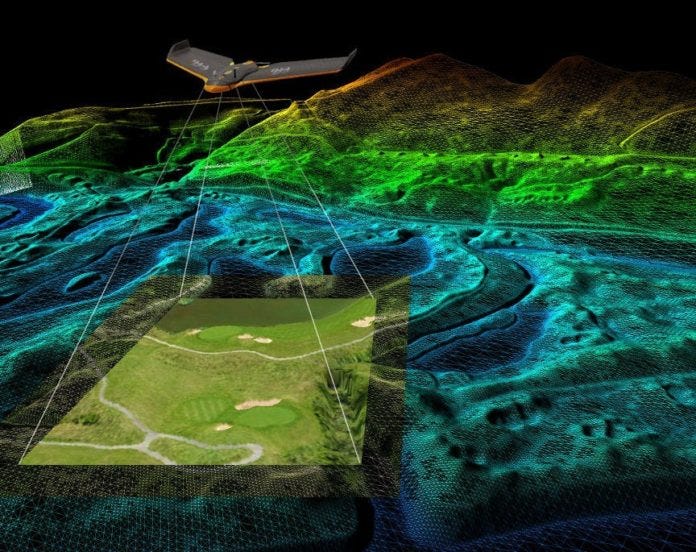
Second Image
Using drones for surveying and mapping projects has several benefits, including cost savings and time efficiency. Traditional surveying and mapping would require more manpower, equipment, and time than what is currently being utilized. Data from drones can also help determine the specific areas that need improvement, allowing mapping and surveying professionals to allocate resources more efficiently.
The data captured by drones can also be used for different applications, such as planning and development, risk assessment, project monitoring, and emergency response. In the construction industry, for example, drones can provide a detailed view of the site that can be used to create 3D models and simulations to optimize the construction process. Drones can also help survey the site during and after construction to check for progress and compliance with safety standards.
In the agricultural industry, drones can be used to assess crop health and yield, identify areas where water and nutrients are scarce, and create soil maps. These data points are essential for farmers to optimize their crop yield, reduce their costs, and improve their environmental footprint.
Third Image

The real estate industry has been one of the most significant beneficiaries of drone technology. Drones can capture high-resolution aerial images that can be used to create 3D models of a property. This technology can be used to showcase the property to potential buyers, providing more detailed insights into the property’s features and potential. This data can also be used to identify potential issues that need to be addressed before the property is listed, such as drainage issues or roof damage.
Drones can also be used to assess the surrounding area, providing insights into the neighborhood and potential development plans. This data can be invaluable to developers and investors as it allows them to make more informed decisions that could impact the property’s value.
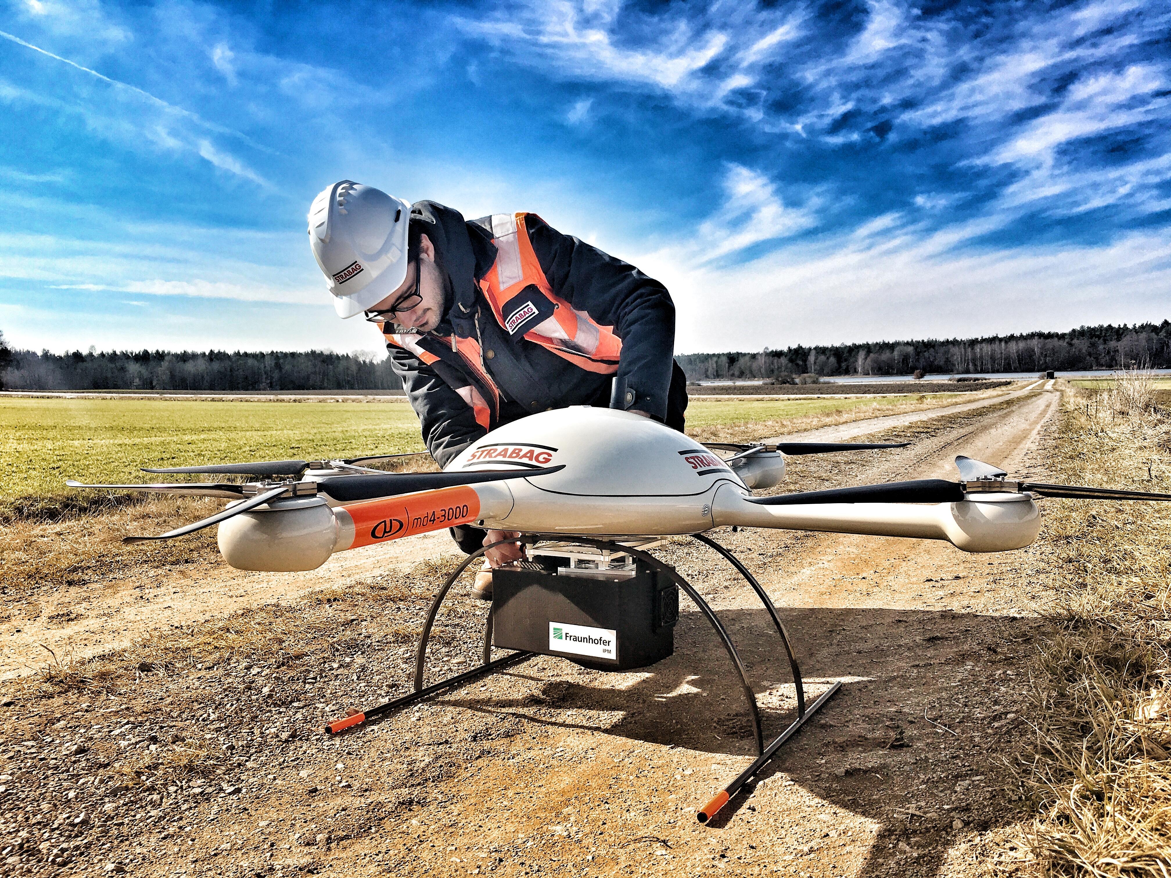
Fourth Image

Another industry that can benefit from the use of drones is the mapping and aerial photography industry. Drones can be used to capture images and data from a higher vantage point that is not possible from the ground. This data can be used to create detailed maps, 3D models, and simulations that can be used in various applications, such as urban planning and environmental surveys.
The use of drones for mapping and aerial photography has also opened up new opportunities for professional drone pilots. Drone pilots need to be knowledgeable in the use of drones and their respective cameras to capture high-quality images and data. They must also be proficient in using software that can process and analyze the acquired data.
Fifth Image
The construction industry can also benefit from drones. Drones can be used to survey construction sites, providing critical information such as the locations of underground utilities, surface elevations, and more. They can also be used to create 3D models that can be used in project simulations, improving project planning and reducing the risk of costly mistakes.
Drones can also be used to monitor construction sites, providing real-time data on progress and identifying potential issues before they become problematic. They can also be used to ensure compliance with safety regulations and provide insights that can help improve job site safety.
Conclusion
The use of drones for surveying and mapping has significantly impacted various industries. The technology provides a cost-effective and efficient way to gather data that was not possible before, providing detailed insights that can be used to optimize projects and decision-making processes. Drone technology has also provided new opportunities for professionals in the mapping, surveying, and drone piloting industries.
While the technology has many advantages, implementing it correctly requires specialized expertise and knowledge. As the industry continues to evolve, more data will be collected, and drones will become more accessible. We can expect that drones will continue to play a vital role in surveying and mapping and the industries that use them going forward.
Source image : www.pix4d.com
Source image : www.alabamarealtors.com
Source image : www.geospatialworld.net
Source image : geoinfotech.ng
Source image : medium.com


